Nyingchi travel guide
林芝
Cuogao Lake, also known as Basong Lake, is one of Nyingchi's best-known sights. Often called the 'Switzerland of Tibet', it is a beautiful, natural and unspoiled place,…
16 places · In the guidebook: pages 570–587

Nyingchi, Tibet Autonomous Region · AI illustration for China Trip
Quick itinerary
Nyingchi in 5 days
- Day 1
- Bayi Town (八一镇, Nyingchi city)→
- Lulang Town (Sejila Mountain and Lulang Forest)
- Day 2
- Lulang Town→
- Midui Glacier→
- Ranwu Lake→
- Lulang Town
- Day 3
- Day 4
- Suosong Village→
- Namcha Barwa→
- Bayi Town
- Day 5
- Bayi Town→
- Paga Temple→
- Basum Tso Lake
The feel of the place
- Plateau Switzerland
- Cuogao Lake, also known as Basong Lake, is one of Nyingchi's best-known sights. Often called the 'Switzerland of Tibet', it is a beautiful, natural and unspoiled place, and few such places are likely to remain untouched for long.
Border Permit Notes
1. Areas in Tibet that require a border permit: Nyingchi (including Medog), Shigatse, Shannan and Ngari. Processing in Tibet is slow and the procedures are rather cumbersome, so it is best to obtain the permit in your home registration area.
2. Applying in Lhasa: first go to the Lhasa Municipal Public Security Bureau and, with your ID card, obtain a letter of introduction for the permit. Then go to the Armed Police Border Defence Corps to apply. The permit fee is ¥8 and the deposit is ¥30. If you have a passport for overseas travel, you do not need to apply for a border permit.
Preparation and Enquiries
Climate and Best Time to Visit
Nyingchi sits at an elevation of 1000–3000 metres in the lower reaches of the Yarlung Tsangpo in southeastern Tibet. It is Tibet's lowest-lying region and home to one of the world's most dramatic vertical landscape zones. It lies on the Sichuan–Tibet Highway, the essential route to Lhasa, and the scenery along the way is stunning, though in the rainy season landslides and mudslides often cut the road. The trip from Lhasa to Nyingchi is the most relaxed and comfortable of Tibet's touring routes.
Things to see
From Pai Town, cross the Duoxiong La snow mountain and pass through Hanmi, Lage and Bengbeng. You can reach Medog in 3–4 days. This is currently the main route to Medog. On the return trip, you can follow the Yarlung Tsangpo upstream to the 108 km point, then cross the Galong La snow mountain to Bomi, which takes 3–4 days.

Zangbu Badong Waterfalls
1–3 hours · Free
The Badong Waterfalls of Zangbu are in fact two waterfall clusters. Two falls, 35 metres and 33 metres high, follow one another on the riverbed 600 metres apart. The cascades are powerful and spectacular, making them China's most primitive and mysterious waterfall group, known as “the hermit of the Grand Canyon” and “China's most beautiful waterfall.”

Namcha Barwa
2–4 hours · ¥150 (entrance ticket plus sightseeing bus)
Namcha Barwa Peak stands at the meeting point of the Himalayas and the Nyenchen Tanglha Mountains. It is the highest peak at the eastern end of the Himalayas, with an elevation of 7,756 metres. The main summit rises high into the clouds, and there are numerous hot springs at the foot of the mountain. The vegetation here is exceptionally lush, making it an ideal destination for adventurous mountaineering and recuperation.

Basum Tso Lake
Basum Tso, also known as Cuogao Lake, means “Three Rocks, Three Lakes” in Tibetan. It is a famous sacred lake and pilgrimage site of the Nyingma school. The water is so clear that you can see straight to the bottom. Snow-capped mountains surround the lake and are reflected in its surface, while birds such as ruddy shelducks, gulls, and cranes drift quietly across the water. About 100 metres from the shore lies a small island called Tashi Island. Legend says it is a “hollow island,” meaning that it is not connected to the lakebed but floats on the surface. Prayer flags flutter on Tashi Island, and the exquisite Cuozong Gongba Monastery (meaning “castle in the lake”) belongs to the Nyingma school of Tibetan Buddhism, known as the Red Sect. It enshrines Padmasambhava and has a history of 1,500 years. According to local legend, on the 15th day of the fourth month of the Tibetan calendar (around 1 June each year), a long white band emerges from the centre of the lakebed beneath the deep blue water. Locals believe it is a giant white khata offered to King Gesar. On this day, local people also observe the custom of walking around the lake.
2–5 hours · ¥120 (May–October), ¥60 (November–April)

Niyang River Scenic Belt
The Niyang River is the largest tributary on the north bank of the Yarlung Tsangpo and is likened to ‘the tears of a goddess’; locals affectionately call it the ‘Mother River’. The river’s colour is exceptionally beautiful, its water as green as jade. When in motion, it surges and churns, sending up white spray; when still, it is clear and bright, like a piece of jade set into the landscape. A huge boulder stands in the middle of the rapids, sending up a spray of foam as the current rushes past.
Photography · Nature
Sejila Mountain
You would never expect delicate rhododendrons to bloom wildly on mountains at altitudes of 2,900 to 5,300 metres. From mid-April to late June, and especially in June, the whole mountain bursts into bloom with rhododendrons in yellow, white, purple, deep red, light red and pink, in a dazzling variety of forms, magnificent and vast. Here you can enjoy a journey that begins in farmland and orchards above 2,000 metres, rises into vast primeval forest on the mountainside, then gives way to alpine meadows and herds of yaks and horse caravans. If you are lucky, you may see fierce black Tibetan mastiffs with red threads around their necks, held on iron chains. Further up lies the desolate forbidden zone of life, where there is nothing but mani stone piles and fluttering prayer flags. Beyond the pass at over 5,000 metres, a stretch of misty switchbacks awaits.
1 hour
Lulang
This is the end of the Nyingchi route. On the far side of Mount Sejila lies a small mountain village where every house is built of timber, and a winding little river flows behind them. A large timber yard is piled high with the branches of ancient trees, and a few horses wander among the enormous trunks. Looking at the growth rings of trees over a metre in diameter, each circle seems like a world of its own. The scenery of Lulang is like an oil painting: mist always clings to the mountainside, mushroom-capped livestock pens dot the slopes, the grasslands are green and damp, and the flowers show the vivid, bright colours that oil paints can never quite capture. In the tranquil town, Tibetan Buddhist monks carry medicine for headaches in their hands as they come and go between villages.
0.5–1 day
Medog
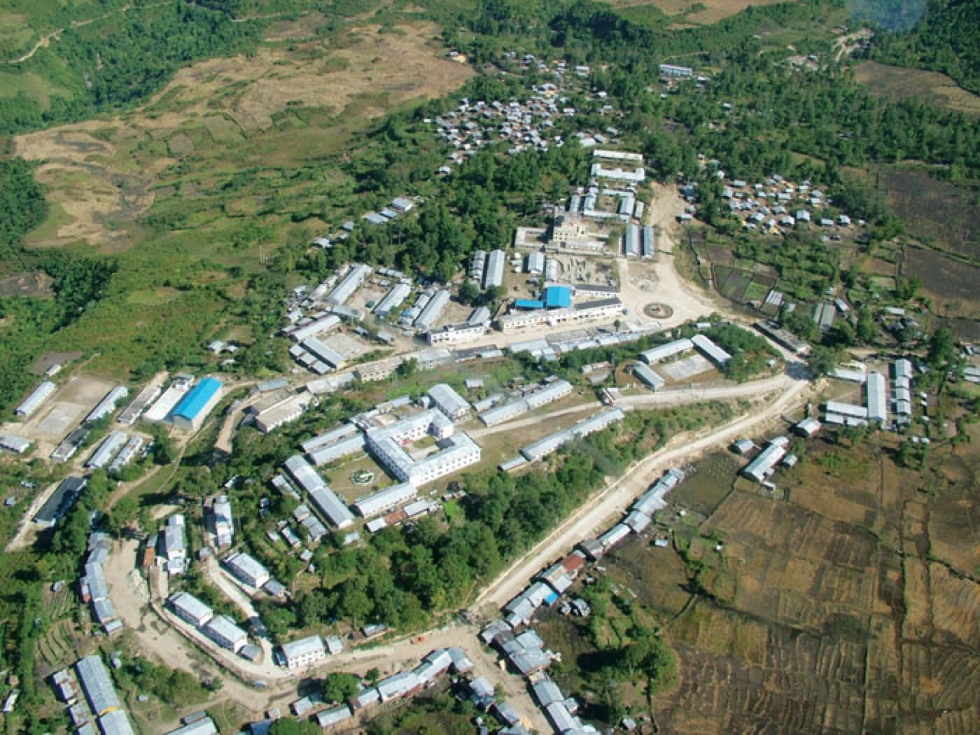
In Tibetan, Medog means “the hidden lotus.” This was once the last place in China without a road. Local people still keep an almost primitive way of life, and the main section of the Yarlung Zangbo Grand Canyon lies hidden here. Vine bridges and cable slides remain the main ways of getting around Medog and are its most distinctive features. The Dexing vine bridge, one of Medog's best-known, has spanned the Yarlung Zangbo River for over 300 years. As you walk across, the bridge sways sharply from side to side with your weight and the wind, a real test of nerve. Crossing by cable slide, you hurtle head-first towards the far bank with your back to the river; it takes considerable courage and good balance to get across safely.
6 days
Bomi
Standing among the ruins of the Galang Palace in Bomi, you can easily sense the bold ambition and commanding presence of the Bomi king, who once stood in defiance against the Tibetan king. From Duodong Temple, follow Zhamo Road uphill to reach the Lotus Sacred Lands: Gawalongba and the Gawalong Heavenly Lake. Along the way, you will often encounter sika deer that are too quick to dodge and striking red-feathered pheasants, where people and nature live in harmony. Along the cliffs, there are countless snow-capped mountains and glaciers. The local food is also a feast for the senses. In Zhamu Town, the county seat, you can try Bomi fish, Yigong toon shoots, bracken fern, fish mint (zheer gen), matsutake mushrooms, morels, free-range chicken, and Tibetan pork.
Hiking & Outdoors · Photography · Mountains & Adventure · Nature
Yarlung Tsangpo Grand Canyon
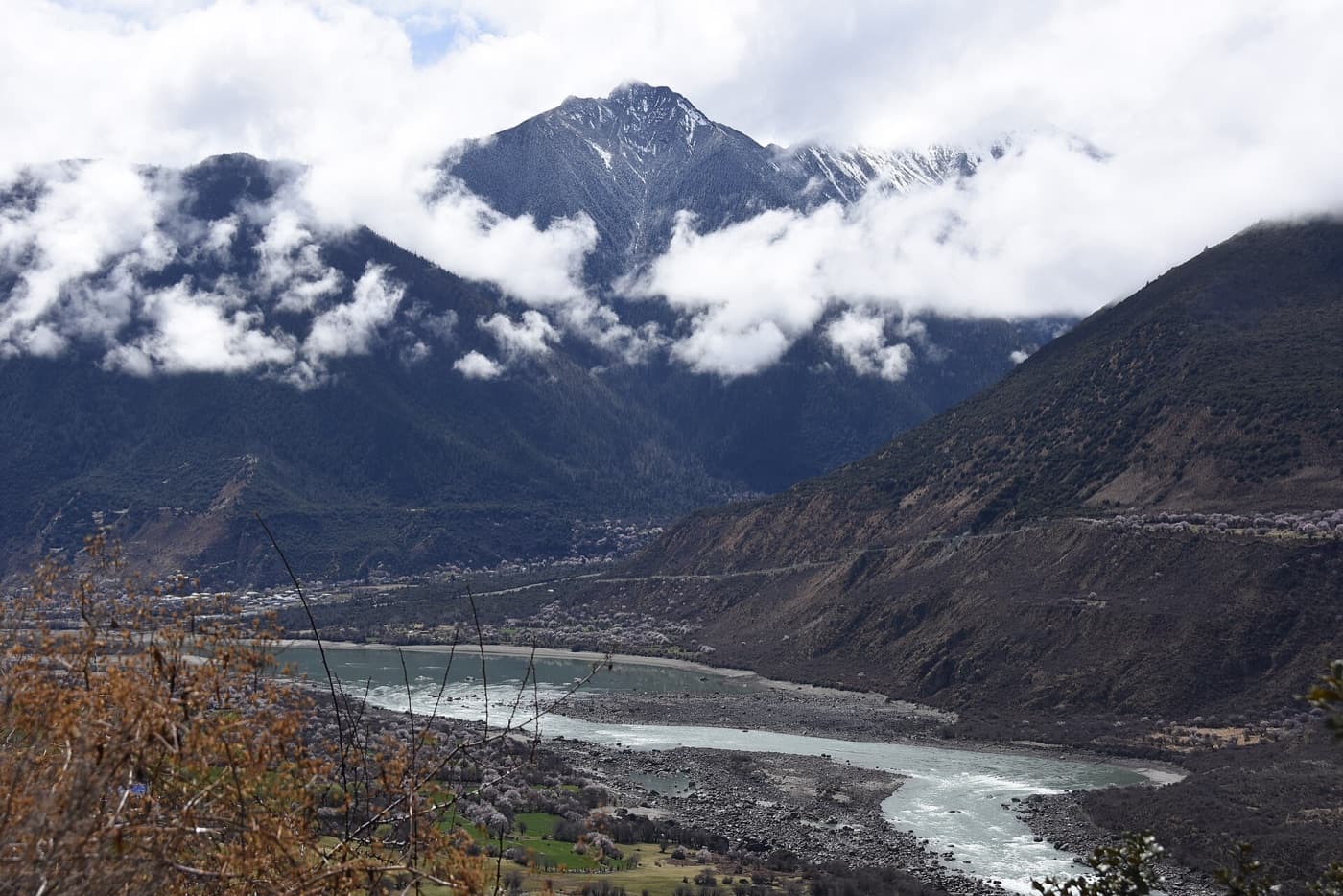
Located on the Qinghai-Tibet Plateau at an altitude of over 3,000 metres, the Yarlung Tsangpo Grand Canyon stretches 496 kilometres. Deep and precipitous, it has been eroded downward by more than 5,380 metres. It contains nine vertical ecological zones, from high-mountain snow and ice belts to low-altitude tropical monsoon rainforests, making it the most complete and well-preserved example of vertical mountain ecosystems in the world. The canyon is also home to a wealth of biological resources, and it is known as “the most beautiful canyon in China.”
1–2 days · Entrance ticket ¥150; sightseeing bus ticket ¥90 (peak season). Entrance ticket plus sightseeing bus ticket ¥128 (off-season).
Midui Glacier
The main peak of the Midui Glacier rises to 6,800 metres, with a snow line at 4,600 metres and a terminus at only 2,400 metres, making it the glacier with the lowest snow line in the world. The Midui Glacier is formed by the confluence of two world-class ice falls. Each falls more than 800 metres high and over 1,000 metres wide, with a primeval forest between them. Alpine flowers bloom around the glacier, reflecting the snow-capped peaks, while forests stretch out as far as the eye can see, with silver snakes dancing in the mist. The Midui Glacier was named by China National Geography magazine as one of the six most beautiful glaciers in China.
3–4 hours · ¥50 (sightseeing shuttle bus ¥35)
Bonri Sacred Mountain
Bonri Sacred Mountain boasts beautiful scenery, as well as a variety of birds and trees. It is the source of many rivers, including the Yarlung Tsangpo and the Nyang River. Local people follow the Bon religion, and Ajiong Jiebo is revered as the hero who protects the sacred mountain. During the Saga Dawa Festival each year, Bon believers circumambulate the sacred mountain counterclockwise.
1 day · ¥70
Nanyigou Valley
Nanyigou Valley is an important birthplace of the mysterious Tibetan medicinal culture and is known as the ‘Valley of the Tibetan Medicine King’. Legend has it that the ancestor of Tibetan medicine once practised healing and taught disciples here. The valley is not only beautiful but also home to the little-known Lhoba culture. Its scenery and customs are unique, earning it the reputation of a mysterious ‘Shangri-La’.
2–3 hours · Entrance ticket ¥110; sightseeing bus ¥90
Lulang Forest Sea
Lulang Forest Sea is a classic long, narrow strip of highland mountain meadow. The ‘sea’ of trees consists of shrubs and dense spruce and pine on the flanks of the green mountains, dominated by evergreen oak, while the centre is a neatly uniform meadow crossed by winding streams. The area is also home to a great variety of birds. The Lulang Flower Sea Pasture, within the Lulang Forest Sea, is exceptionally beautiful. From May to June each year, a riot of colourful flowers blooms, making it hard to leave. Apart from admiring the meadows and forest scenery, horseback riding on the pasture is also a great option.
1–2 hours · ¥170; viewing platform ¥30
Taohua Valley (Peach Blossom Valley)
This site has been selected as one of the ‘Most Beautiful Viewing Spots’ in Tibet in the China National Geography list. Warm, moist air from the Indian Ocean travels northward along the canyon into the plateau. Suitable temperatures and abundant rainfall nurture the enchanting, graceful peach blossoms. Starting in March each year, peach blossoms begin to adorn Bomi’s natural landscape, carpeting hillsides and river valleys in a dazzling sea of flowers.
1–3 hours · Free
Buddha's Palm Sand Dunes
Buddha’s Palm Sand Dunes lie on the north bank of the Yarlung Tsangpo in Danniang Township, Milin City. Their shape, together with their reflection on the river, resembles a Buddha’s palm pressed together in prayer, hence the name. Located in a strong wind corridor on the middle and lower reaches of the Yarlung Tsangpo, the dunes have been battered by gales blowing with hurricane-like force from late autumn to late spring. River sand exposed during the dry season is blown, carried and piled up year after year, forming this unique landform. Within Milin’s section of the Yarlung Tsangpo, its scale is second only to the Wolong Big Sand Dune.
1 hour · Free
Kading Gully
Kading Gully, also known as the Kading Heavenly Buddha Waterfall, is not large. Steep black cliffs rise on both sides, towering trees fill the gully, and grasses grow lush. Deep inside the scenic area, a natural waterfall plunges down in a truly awe-inspiring sight.
1 hour · ¥45
Getting there & around
By Air
Nyingchi Mainling Airport lies in the Yarlung Tsangpo valley in Mainling, Nyingchi, about 40 km from Nyingchi city centre (Bayi Town). Flights currently operate to Chengdu, Chongqing, Guangzhou, Xi'an and Lhasa. Shuttle buses run between the airport and the city centre with no fixed timetable; a bus waits whenever a flight arrives. The fare is ¥25.
phone: 0894-5482731
address: Mainling, Nyingchi
By Road
At present, buses and cars are the main means of transport for getting to Nyingchi.
Coach: Lhasa–Nyingchi coaches depart daily from 8:00, fare ¥247.
Car hire: if you have plenty of time, you could first travel the Everest route, then contact a driver directly, without going through a travel agency, to cover Nyingchi–Lulang–Cuogao Lake, about 1000 km in total. With good road conditions the round trip takes 3 days, and the cost is around ¥3000.
tip: 1. Road conditions: the Lhasa–Nyingchi road is mostly paved, which for anyone who has driven other Tibetan routes feels like paradise; an ordinary Santana can handle it. The roads to Lulang Town and Basong Lake have also been paved.
2. Hitchhiking tips: When hitchhiking along the Sichuan-Tibet and Yunnan-Tibet highways, keep a few things in mind. Fairly regular rides are timber trucks running from Bomi, Zayü and other places to Chengdu, and jeeps and Santana cars that occasionally carry passengers to Chengdu. Each county has a guesthouse that serves as a gathering point for drivers, such as the Grain Bureau Guesthouse in Bomi and Ping'an Hostel in Ranwu. If you wait at the Sancha Crossroads early in the morning, you may also catch vehicles coming up from Zayü. There are many army way stations along the Sichuan-Tibet Highway, and they are usually happy to host travellers.
Car Rental
To reach major sights such as Basong Co from Nyingchi, you can rent a jeep at the post and telecommunications office in Bayi Town. Each jeep seats up to 6 people.
Ethnic Groups
Nyingchi is home to the Monpa, Lhoba and other ethnic minorities. Their way of life and religious beliefs retain a strong traditional character, giving the area a distinctive ethnic flavour.
Food and Accommodation in Lulang Town
1. A modernised Tibetan-style town, where accommodation and dining have improved dramatically.
2. Bringing your own sleeping bag is important. The moths in the porches could almost be considered one of Lulang's sights: big and small, they cluster densely on the walls.
3. Lulang's mushrooms are absolutely delicious. Guesthouse restaurants offer few vegetables, but you can enjoy all kinds of mushrooms.
4. Red-braised pork stewed with matsutake is the best choice. Its storage time and preservative content are unknown, but once you taste it with Tibet's most famous mushroom, you'll forget everything else. A plate usually costs ¥20–30, and a few varieties are a little pricier, but they are good value.
5. Lulang's signature dish is stone-pot chicken, which was featured in the documentary series A Bite of China. Almost every small eatery in town serves it.
Self-Driving
Rail
Daily trains depart Lhasa Station at 8:00, 13:45 and 17:15, running direct to Nyingchi Station. Second-class seats cost ¥129.
Lhasa → Nyingchi
Self-DrivingAlong National Highway 318 (Sichuan-Tibet Highway) from Lhasa → Dazi → Mozhugongkar → Gongbo'gyamda (crossing Mila Pass) → Baiba Town → Bayi Town. Total distance: 407 km.
Chamdo → Nyingchi
Self-DrivingAlong National Highway 318 (Sichuan-Tibet Highway) from Chamdo → Bomi → Lulang Town → Bayi Town. Total distance: 719 km.
Shannan → Nyingchi
Self-DrivingAlong Tibet Provincial Highway 306 from Shannan → Lhünzê County → Milin town → Nyingchi Airport → Ganggar Bridge → Bayi Town. Total distance: 370 km.
Gongshan County, Yunnan → Nyingchi
Self-DrivingAlong the Gongcha Highway from Gongshan County, Yunnan → Zayü County in Nyingchi → Ranwu Town in Chamdo (along the Ranzha Highway) → Bomi County (along National Highway 318) → Bayi Town. Total distance: 2,600 km.
Eat & drink
Nyingchi's cuisine follows traditional Tibetan flavours and also features specialities of other ethnic groups. Wild mushrooms such as matsutake, which grow in Nyingchi, are celebrated as gourmet delicacies.
Tibetan Xiang Pig
Rich but not greasy. Some restaurants in Bayi Town serve dishes made with Tibetan Xiang pig, but you'll need to ask around, as it isn't available everywhere.
Where to stay
Hotels and guesthouses in Nyingchi are mostly concentrated in Bayi Town, which has the best transport links. There is a good range of hotels at different price levels, such as the Nyingchi Guesthouse, the Agricultural and Animal Husbandry College Guesthouse and the Nyingchi Hotel. In remote areas, you can camp. If you're touring the Yarlung Tsangpo Grand Canyon area, you can choose to stay with local families, but remember to follow local customs.
Shopping
The abundant forests yield a wide range of economic and medicinal plants. Common examples include wuyanguo, used to treat heart disease; Hainan cephalotaxus, with anti-cancer properties; santai flower, which prevents malaria; yanling grass, said to promote longevity; and heijie grass, which soothes the throat. Important Tibetan medicinal materials include nansuanzao, gouteng and shihu, while prized herbs include Paris polyphylla, beimu (fritillary bulb), snow lotus and caowu (monkshood). Nyingchi also has handicrafts unique to its ethnic groups: Monpa wooden bowls, bamboo weaving, and Lhoba stone pots and pottery.
Source: China Self-Guided Travel 2025 (《中国自助游》, Tianjin Science & Technology Press, Aug 2024), pp. 570–587. Translated from the Chinese edition; names and prices follow the guidebook. · Plain text version