Mao'er Mountain
The highest peak in South China, located on the border between Xing'an and Ziyuan counties, with its main summit at about 2,141 metres above sea level.…
Mao'er Mountain, Northern Guangxi
Key facts
- Admission
- ¥160 (includes entrance ticket, sightseeing bus and insurance)
- Opening hours
- 8:00—17:30
- Time needed
- 4–5 hours
- Getting there
- Direct buses run from Guilin Bus Terminal for ¥11. Hiring a car costs ¥200–300.
- Guidebook rating
- 3 / 5
From China Self Guided Travel 2025, page 2459. Open in Google Maps
About Mao'er Mountain
The highest peak in South China, located on the border between Xing'an and Ziyuan counties, with its main summit at about 2,141 metres above sea level. It is the source of three major Guangxi rivers: the Li (Lijiang), Zi (Zijiang) and Xun (Xunjiang).
Frequently asked questions
How much does Mao'er Mountain cost?
Admission to Mao'er Mountain is ¥160 (includes entrance ticket, sightseeing bus and insurance), as listed in the 2025 guidebook. Prices can change; check the official channel before you go.
What are the opening hours of Mao'er Mountain?
Mao'er Mountain is open 8:00—17:30.
How do I get to Mao'er Mountain?
Direct buses run from Guilin Bus Terminal for ¥11. Hiring a car costs ¥200–300.
How long should I spend at Mao'er Mountain?
Plan on 4–5 hours for Mao'er Mountain.
Where is Mao'er Mountain?
Mao'er Mountain is in Northern Guangxi, Guangxi Zhuang Autonomous Region, in the South China of China.
More places in Northern Guangxi

Longji Rice Terraces
This 650-year-old agricultural landscape is only a small part of what is here, yet it is stunning enough to take your breath away. The ancestors who carved these terraces out of the mountains could never have imagined that their sweat and lives would produce such graceful, curving scenery. Spectacular views combined with a touch of local culture make for an unforgettable visit. Along the way you will meet Yao women and Zhuang men, who make wonderful subjects for photography. Working villagers and the terraces at sunset create scenes that are beautiful beyond imagination. Best of all, you can stay in a family guesthouse, enjoy farmhouse chicken while looking out over the terraces, and experience the rhythm of terrace farming for yourself. To see the terraces at their most captivating, choose the right season. In April and May, the terraces are flooded and planted with rice, and the water glitters, making it the best time for photography and sightseeing. September is also worth considering, when the terraces turn golden with ripening grain.
¥80 · 1–2 days
Bajiaozhai (Eight-Corner Fortress)
Located on the border between Hunan and Guangxi. Its vivid red rock mass rises abruptly into the sky, with eight horn-like peaks jutting from the summit, resembling eight majestic dragons soaring into the distance. The imposing, steep landscape is truly unique. From the Longtou Xiang (Dragon Head) viewpoint, you can gaze at distant danxia (red-rock) scenery, and up close you can see deep chasms and sheer cliffs.
¥148 (includes shuttle bus ticket) · 2–3 hours
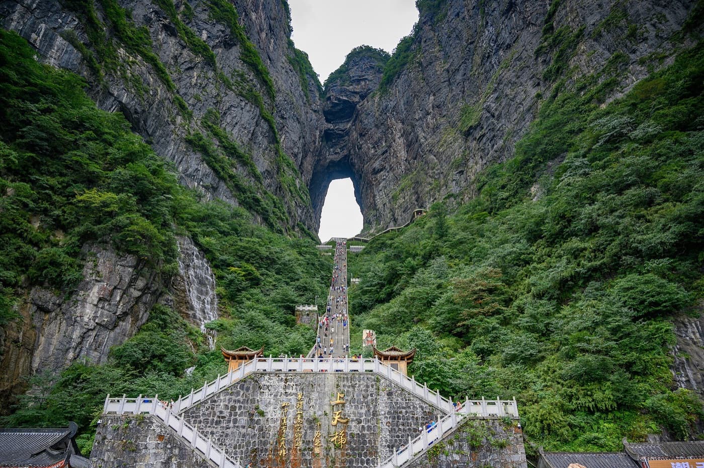
Tianmen Mountain
Tianmen Mountain has graceful peaks and striking ravines. Highlights include the typical danxia landforms of Tianji (Heavenly Ridge, a stone beam), Shenxian Zhai (Immortal Village, a stone stockade) and Yixian Tian (One-Line Sky, a narrow stone alley). Statues honour Shennong, the Emperor of Medicine; Zhang Zhongjing, the Sage of Medicine; and Hua Tuo, the Divine Physician. Religious buildings include Tianmen Temple, Guanyin Temple, the Medicine Buddha Hall and the Earth God Shrine. Inscriptions by renowned calligraphers include Zhao Puchu’s “Lin He You Mei” (Serene Forest and Valley), Lin Zhiyuan’s “Tianxia Diyi Yaogu” (The Number One Medicinal Valley Under Heaven) and Qin Yusheng’s “Zhi Zhe Le Shui” (The Wise Delight in Water), together creating a picture of a hidden paradise.
¥28 · 2–3 hours
Zijiang River Rafting
The Zijiang River rises at Mao'er Mountain, 2,141.5 metres above sea level, and flows for more than 40 km with a natural drop of over 1,000 metres. The river is full of rapids and sharp bends: 58 rapids and 56 bends in total. The scenery along its banks is dramatic, with many attractions scattered along the way. Several wharves along the Zijiang allow visitors to launch rafting trips. On the section from Sanhao Wharf, the river is only a few dozen centimetres deep at its shallowest and more than 30 metres deep at its deepest; the route passes 33 bends and 45 rapids. The most challenging stretch is the Wupai River, where the water drops a striking 300 metres.
Wooden boat ¥90/person; rubber raft ¥500/raft (up to 6 people), ¥350/raft (up to 3 people) · 1–3 hours
Chengyang Eight Villages
The Chengyang Eight Villages are Ma'an (马鞍寨), Ping, Yan, Dong (董寨), Dazhai, Pingtan (平坦寨), Pingpu (平埔寨) and Jichang (吉昌寨). Visitors can watch folk performances that showcase Dong culture, with plenty to see and do. It is an excellent destination for sightseeing, photography and experiencing Dong culture. Chengyang Bridge is a precious cultural relic and deserves a close look.
¥90 (includes sightseeing bus) · 0.5–2 days
Longtan National Forest Park
This national AAAA-rated scenic area offers classic karst landscapes as well as the culture of southern ethnic minorities. Twenty-four peaks of varied shapes, including Wohu Shan (Crouching Tiger Mountain), Meinü Feng (Beauty Peak) and Kongque Shan (Peacock Mountain), rise around one lake (Jinghu, or Mirror Lake), two pools (Longtan and Leitan) and four valleys, forming a breathtaking landscape scroll.
2–3 hours